Summary
Overview
Work History
Education
Skills
Affiliations
Timeline
Darnell Manning

Darnell Manning

Honolulu,Hawaii

Summary

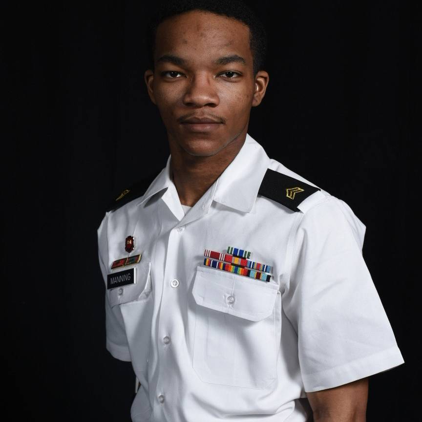
Darnell Led multiple GIS and mapping projects as Non- Commissioned Officer in charge for large development organization. Developed topographical data for use with presentations. Versed in developing engineering plans in multiple disciplines. Darnell lead Soldiers and junior leaders to complete mission and quality check work to be sure that task and missions were completed effectively and efficiently. Was responsible for Soldiers day to day life issues and records were up to date and stored properly. Darnell is a detail-oriented team player with strong organizational skills. Ability to handle multiple projects simultaneously with a high degree of accuracy. During a deployment in 2018 Darnell earned several challenge coins and 2 meritorious awards along with an Army good conduct medal.

Overview

7
7
years of professional experience

Work History

Senior Geospatial Engineer Sergeant

U.S. Army Active Duty
08.2022 - Current
  • Proficient in GIS analysis, documentation and mapping.
  • Prepared engineering plans as directed by leading engineers and project managers through use of verbal instructions and blueprints.
  • Implemented collected data to enhance design and development of drawings.
  • Demonstrated exemplary skills in operating standard office equipment not limited to ARC MAP, ARC GIS, ENVI, ERDAS, ARC PRO.
  • Presented briefings on maps and exhibits using PowerPoint and Adobe Software.
  • Built and maintained database by inputting field data, drawings and project information.
  • Trained, supervised and organized over 13 soldiers and personnel.
  • Managed over $1,000,000 worth of equipment during garrison and deployment operations.
  • Led team in developing strategic plans to meet operational objectives.
  • Monitored and assessed mission progress and provided updates to command.
  • Developed and distributed health education materials to increase awareness and understanding.
  • Maintained accurate and complete records to document program activities and outcomes.
  • Reviewed complaints and claims from workplaces about civil rights, determined validity and helped build satisfactory resolutions.
  • Planned workshops to help workplaces remain complaint free and support diverse employees.
  • Analyzed team performance and identified opportunities for additional training.
  • Identified team weak points and implemented corrective actions to resolve concerns.
  • Trained employees on ARC GIS programs and assigned duties.

Geospatial Engineer Sergeant

U.S. Army
11.2019 - 07.2022
  • Proficient in GIS analysis, documentation and mapping.
  • Presented briefings on maps and exhibits using PowerPoint and Adobe software.
  • Worked closely with Senior Designer by providing program support and fulfilling delegated responsibilities.
  • Trained and mentored 10 junior geospatial imagery analysts from 2014 - 2022.
  • Presented GIS software systems and data collection methods via training courses.
  • Recommended procedures, equipment or software upgrades to increase data accessibility or ease of use.
  • Transferred and rescaled information from aerial photographs to complete maps.

Geospatial Engineer

U.S. Army
08.2016 - 11.2019
  • Proficient in GIS analysis, documentation and mapping.
  • Built and maintained database by inputting field data, drawings and project information.
  • Demonstrated exemplary skills in operating standard office equipment not limited to computer programs and printing equipment.
  • Presented briefings on maps and exhibits using PowerPoint and Adobe software.
  • Worked closely with Senior Designer by providing program support and fulfilling delegated responsibilities.
  • Used Geographic Information Systems technology and equipment to produce detailed maps.
  • Managed GIS databases and modified parameters for different needs.
  • Transferred and rescaled information from aerial photographs to complete maps.
  • Conferred with users to analyze, configure or troubleshoot applications.
  • Evaluated and enhanced current cartographic representations.
  • Presented GIS software systems and data collection methods via training courses.
  • Completed over 1000 products during time in North Carolina

Education

Bachelor of Science - Signal/Geospatial Intelligence

Texas Southern University, Houston, TX
01.2026

Bachelor of Science - Computer Science

Lincoln Land Community College, Springfield, IL
01.2026

High School Diploma -

Moanalua High School, Honolulu, HI
05.2015

Skills

  • GIS Applications and ESRI Software
  • Human Resources
  • Training, counseling, and small group instruction
  • Quality Checks
  • Planning
  • Operational Efficiency
  • Critical Thinking
  • Satellite Imagery
  • 3D Visualization and Data Representation
  • Military Operations
  • Analysis Proficiency
  • Digitizing Skills

Affiliations

  • Prince Hall Free and Accepted Mason

Timeline

Senior Geospatial Engineer Sergeant - U.S. Army Active Duty
08.2022 - Current
Geospatial Engineer Sergeant - U.S. Army
11.2019 - 07.2022
Geospatial Engineer - U.S. Army
08.2016 - 11.2019
Texas Southern University - Bachelor of Science, Signal/Geospatial Intelligence
Lincoln Land Community College - Bachelor of Science, Computer Science
Moanalua High School - High School Diploma,
Darnell Manning