
TYLER BALEY
Vancouver
Summary
Field & Lab Technician with proven track record in productivity and efficiency. Expertise in archaeological field work, data collection, GIS, and high precision survey techniques including GPR, Remote Sensing, and GPS. Strong critical thinking and communication skills drive optimal results in challenging environments. Unique skill set enhances project outcomes beyond typical archaeological capabilities.
Overview
5
5
years of professional experience
Work History
Field Tech for Various Projects
Various Projects by Contract
08.2021 - Current
- Executed fundamental archaeological tasks in CRM settings, ensuring adherence to protocols.
- Adapted to hot, dry climates while sustaining high productivity levels.
- Lifted heavy equipment, fulfilling all physical job requirements.
- Contracted for state and city projects, delivering superior results.
- Created high-quality deliverables tailored to client specifications.
- Authored comprehensive reports, documenting findings accurately.
Research Assistant
Northwest Coast Archaeology Lab
01.2020 - Current
- Supported Dr. Colin Grier over five years on multiple lab initiatives.
Performed GPS and GPR surveys in diverse outdoor conditions.
Employed total station alongside standard archaeological instruments for data accuracy.
Created digital field maps to streamline data collection processes.
Maintained GIS databases, ensuring systematic data organization.
Georeferenced legacy data sets, enhancing their usability and accessibility.
Thrived in both laboratory settings and fieldwork scenarios.
GIS Data Processing
National Parks Service
09.2023 - 05.2024
Created field maps for data collection. Processed field data collected in GIS. Created and organized GIS databases.
GIS Data Processing & Technical Support
University of British Columbia & Washington State University GIS Working Group
01.2023 - 03.2024
- Developed field maps to enhance data collection processes.
- Processed GIS field data to ensure accuracy and reliability.
- Created and organized comprehensive GIS databases for efficient data management.
- Collaborated with GIS specialists to troubleshoot workflow challenges.
Presenter
Society for American Archaeology
04.2023 - 04.2023
- Showcased results of extensive geophysical survey at Fort Clatsop, OR at 2023 Society for American Archaeology Conference
GIS Technical Support & Training
Klamath Tribal Counsel
01.2023 - 04.2023
- Facilitated training in basic GIS data management and workflows pro bono
Education
Masters - Anthropology with Thesis
Washington State University
Pullman, WA12.2025
GIS and Drone Certificate - Geographic Information Systems
Portland Community College
Portland, OR04.2023
NPS CRM Field School - Archaeology
Washington State University
Vancouver, WA08.2021
Bachelors - Anthropology with formal minors in History & English
Washington State University
Vancouver, WA07.2021
Associate in Arts -
Clark College
Vancouver, WA06.2019
Skills
- Field technology expertise
- Spatial analysis and GIS
- GPR surveying techniques
- Photogrammetry and 3D modeling
- Drone piloting skills
- Mission planning with UgCS
- ArcGIS Pro and Online proficiency
- Web map hosting solutions
- Story map creation
- Technical report writing
- Knowledge of NAGPRA and NHPA
- Section 106 compliance expertise
- Geographic information systems proficiency
- Field data collection methods
- Site reporting practices
- Database management systems
- Data visualization techniques
- Team collaboration skills
- Research methodologies
- Laboratory report writing
- Field operations management
- Technical writing proficiency
- Data collection strategies
- Hardware and software installation expertise
- Technical analysis skills
- Sampling techniques knowledge
- Effective written communication
- Diagnostics and troubleshooting capabilities
Accomplishments
- Recipient of the 2024 Robert “Bob” Ackerman Endowed Fellowship in Archaeology
- Experience working with sensitive datasets under the terms of an NDA
- Over 300 hours of flight time with survey-grade drone mapping systems and associated technologies
- Performed the spatial analysis and other GIS work for a series of surveys at Fort Clatsop, OR
- Presented at the 2023 Society for American Archaeology Conference
- Invited to and attended the 2022 Esri Global User Conference and Education Summit
- Interned with Dr. Colin Grier
- Invented methods for georectifying data sets and consolidating legacy data sets
TYPICAL DUTIES & RESPONSIBILITIES
- Compile current and/or consolidate legacy date to create GIS databases for both public and private archaeological projects
- Create GIS-based deliverables for both public and private institution use
- Create Orthomosaics, DEM's, and other 3D data derived from drone survey
- Program flightpaths and serve as the PIC or RPIC for UAS missions
- Create and prepare digital field maps for data collection
- Co-author official archaeological reports and formal presentations
- Co-author on several forthcoming research papers
- Perform GPR survey and processing the resulting data
- GPS data collection
- Data collection in the field
- Teach technical skills in GIS data collection and processing
Portfolio
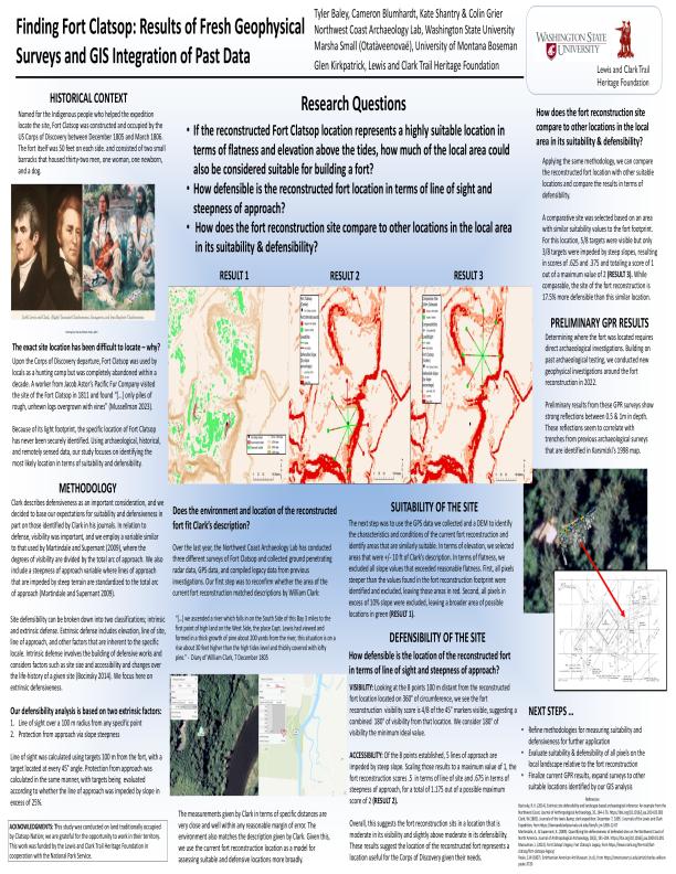
SAA Poster 2023
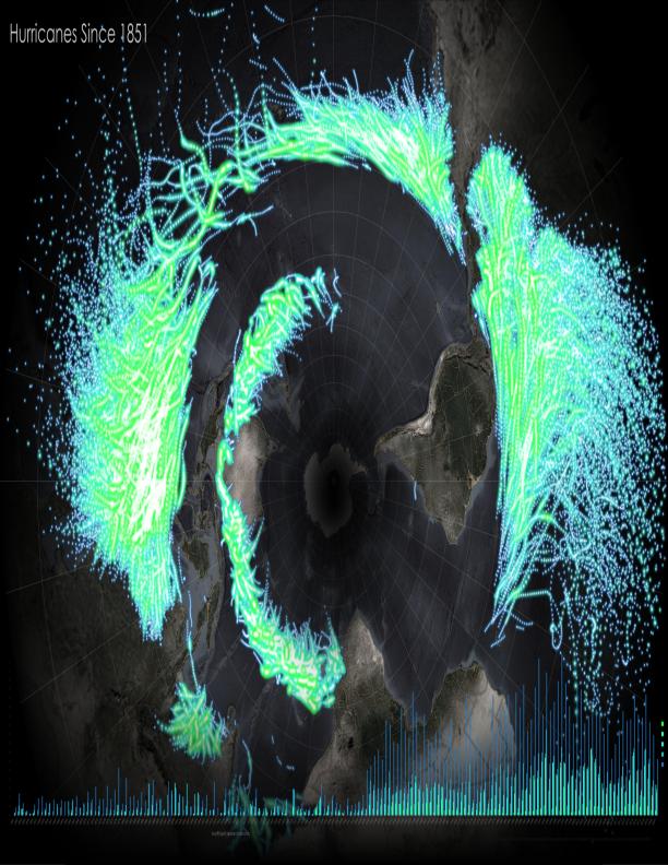
Hurricane Records Analysis
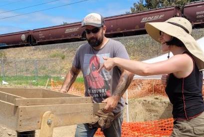
CRM work
Timeline
GIS Data Processing
National Parks Service
09.2023 - 05.2024
Presenter
Society for American Archaeology
04.2023 - 04.2023
GIS Data Processing & Technical Support
University of British Columbia & Washington State University GIS Working Group
01.2023 - 03.2024
GIS Technical Support & Training
Klamath Tribal Counsel
01.2023 - 04.2023
Field Tech for Various Projects
Various Projects by Contract
08.2021 - Current
Research Assistant
Northwest Coast Archaeology Lab
01.2020 - Current
Masters - Anthropology with Thesis
Washington State University
GIS and Drone Certificate - Geographic Information Systems
Portland Community College
NPS CRM Field School - Archaeology
Washington State University
Bachelors - Anthropology with formal minors in History & English
Washington State University
Associate in Arts -
Clark College